


Floatin’ On A Cloud
November 12, 2014
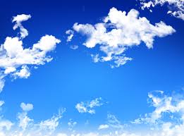
Ever find yourself staring up at the clouds? Daydreaming? There are tons of clouds in the sky and I bet you didn’t know that. Stratus clouds are uniform grayish clouds that often cover the entire sky. They resemble fog that does not reach the ground. Usually no precipitation falls from stratus clouds, but sometimes they may drizzle. When a thick fog lifts the resulting clouds are low stratus.
Nimbostratus clouds form a dark, gray, wet-looking cloudy layer associated with continuously falling rain or snow. They often produce precipitation that is usually light to moderate.
Cirrus clouds are thin, wispy clouds blown by high winds into long streamers. They are considered “high clouds” forming above 6000 m (20,000 ft). Cirrus clouds usually move across the sky from west to east. They generally mean fair to pleasant weather.
Cumulus clouds are puffy clouds that sometimes look like pieces of floating cotton. The base of each cloud is often flat and may be only 1000 meters (3300 feet) above the ground. The top of the cloud has rounded towers. When the top of the cumulus resembles the head of a cauliflower, it is called cumulus congestus or towering cumulus. These clouds grow upward, and they can develop into a giant cumulonimbus, which is a thunderstorm cloud. are thunderstorm clouds that form if cumulus congestus clouds continue to grow vertically. Their dark bases may be no more than 300 m (1000 ft) above the Earth’s surface. Their tops may extend upward to over 12,000 m (39,000 ft). Tremendous amounts of energy are released by the condensation of water vapor within a cumulonimbus. Lightning, thunder, and even violent tornadoes are associated with the cumulonimbus.
Wow! That’s a lot of clouds.